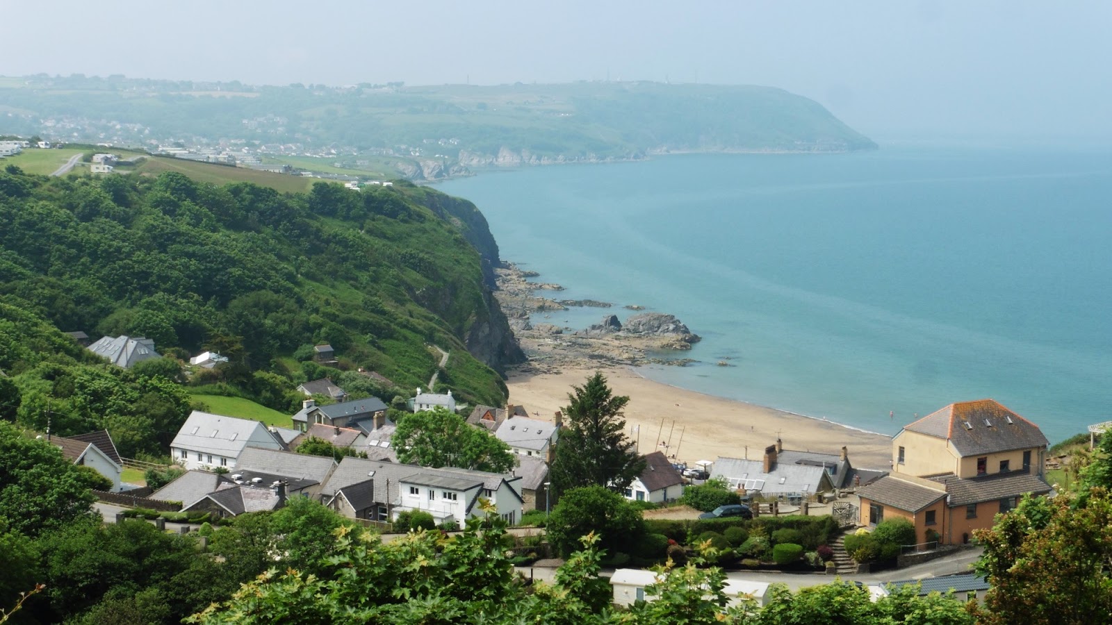
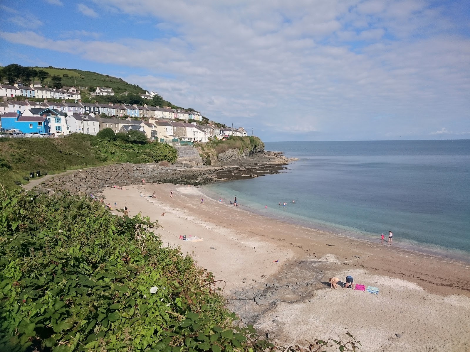
Showing posts with label Ceredigion Coastal Path. Show all posts

Sunday, 24 June 2018

Ceredigion Coastal Path 8 - Aberporth to Cardigan

Today we were setting out to finally complete our challenge of walking the Ceredigion Coastal Path.  The official website stated that this section would be approximately 12 miles over three different stretches - as will be seen, one of us made it all the way!
For me, this was also the opportunity to smash my personal steps record - aiming for 50,000 steps I knew the walk alone would not be enough, so my day started just after 6am with a long walk around the local country lanes - clocking up my first 10,000 steps before breakfast!  

Doing this walk on a Sunday limited our ability to complete the walk using public transport, so we drove to Cardigan and took the still free weekend bus to our starting point at Aberporth.


The first part of the walk involved a long diversion from the coast around MOD Aberporth - with a long road climb up to the base and a short trek through fields / overgrown shrubbery before arriving at the top of the cliff.


The path along the coast here was also very overgrown and we ended up carrying the walking poles as they kept getting caught on the grass. Views of the cliffs below were few and far between, although we'd occasionally catch some dramatic scenery through the foliage.
It was also very still and hot, with lots of annoying little flying creatures buzzing around us (despite the insect repellent), all of which made the 5 miles to Mwnt feel interminable.


It was almost worth it - Mwnt is one place we'd like to return to, although I don't think we'll be walking there from Aberporth again!  It was nice to sit in the sun and refuel (with homemade energy bars), enjoying the view.


Needing the steps for my 50k step challenge (and also because I like going up hills!) I decided to walk up Foel y Mwnt while Sarah continued along the coast path.  The view from the top along to Cardigan Island was stunning and I was fortunate enough to see dolphins. Well worth the effort to get up there, and as I walk much faster than Sarah, it wasn't long before I caught her up, especially as she stopped for an ice-cream from the beach cafe!


The walk from Mwnt to Gwbert (another 3.5 miles) was mostly along the cliff edge, a lot more open and breezy, and with some stunning scenery. This is the one part of this section of the path I could see us doing again.

Initially the walk was enlivened by a small flock of sheep which got themselves stuck on the path ahead of us - we were 'herding' them for some distance before they finally made a break for it - but we also saw dolphins and donkeys.

There was a large diversion inland round Cardigan Island Coastal Farm Park, which involved walking through fields (and not for the last time).


I cannot help but feel the owners of the Park have made an error in not allowing walkers through their property as a few of us may have stopped for tea and cake.

On the hill down to Gwbert, Sarah’s knee was giving her major discomfort, so the decision was made for her to wait in the Gwbert hotel while I continued and collected the car.


This is how Sarah ended her coastal path challenge, chugging cider, as having heard about my experience getting to Cardigan she has no desire to walk it!

The final leg from Gwbert to Cardigan (3.5 miles) followed the estuary, and was lovely, right up to the point where the path turned into a boat yard.
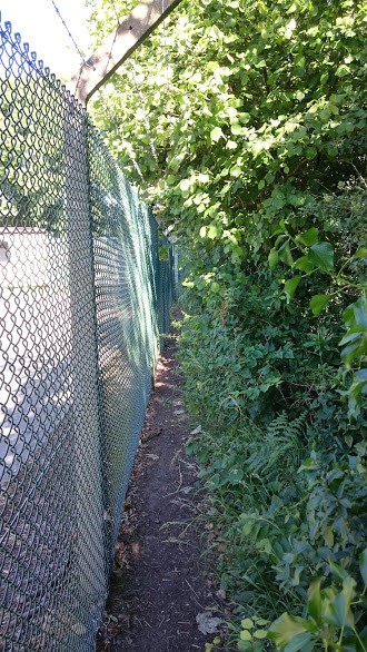

After this, it once more became fields and overgrown paths - I got turned around in one field and could not find the way out, perhaps I missed a signpost, and it was all getting a bit frustrating.

Very unglamourously, the walk finishes with a tight squeeze between the sewage works and an overgrown hedge before arriving in the main Cardigan car park.


Finally got back to the car, collected Sarah from the Gwbert hotel and drove us to Aberaeron for the now traditional post-walk chips - with a final stroll around Aberaeron to knock up a few more steps and reach my 50,000 steps:

It is very unlikely we will walk this complete section again as there were very few enjoyable bits, and for the most part it just seemed like a chore that needed to be finished. This section highlights for me, the difference between walking to complete a task and walking for enjoyment.


The final stats from my GPS recorder:

Distance 23.32km
Duration: 6:52
Moving Time: 6:05
Calories: 2493
Ascent: 679 meters

Sunday, 10 June 2018

Ceredigion Coastal Path 7 - Aberporth to Llangrannog

Another sunny Sunday, so time to get back on the coastal path - retracing our steps from Aberporth to Tresaith and completing the extra few miles to finish back in Llangrannog (where we'd parked up for the duration).

From there we took another Cardi Bach bus trip to the start of the walk in Aberporth, then followed the  'mostly' wheelchair friendly path to Tresaith.  (Although the hedgerows had gotten so high in places that anybody in a wheelchair wouldn't have been able to see much!)

With the dry summer we've been having the waterfall wasn't looking so impressive, and after a brief rest by the beach we followed the road and started the climb, past the Ship Inn and out of Tresaith.

The path climbed quite steeply to the top of the cliff, with some great views back over Tresaith towards Aberporth - although a touch of mist was by then coming in off the sea.

The path hugged the coast for a bit before it turned back inland around Penbryn beach (looking stunning below us):


The footpath descended (quite steeply in places) through green woodland - took a bit of a slip on these steps, but the cool of the wood was otherwise much appreciated, and we paused to admire the stream and the general ambience.


The path finally climbs again to emerge in the National Trust car park by the Plwmp Tart cafe. 

We came close to stopping for tea and cake, but eventually decided to press on - if we'd known then about the climb ahead we may have chosen differently!  It was a steep haul, with the sun very warm after the cool of the woods and the earlier mist, but we were soon back on the cliff path again, enjoying the views, as Llangrannog crept ever closer:


We arrived back in Llangrannog after about 3.5 hours - Martin had hoped to combine this walk with one of the other legs, but I wasn't sure that my legs were up to a 14-16 mile walk! 

I was glad we stuck with the shorter option - time for what Martin would refer to as my 'traditional cider' - sitting in the sun outside the Pentre Arms watching the world go by. 

Finally it was back to the car and home (no chips in Aberaeron today).


The final stats from Martin's GPS recorder:

Distance 9.43km
Duration: 3:25
Moving Time: 2:55
Calories: 1008
Ascent: 395 meters

Sunday, 3 June 2018

Ceredigion Coastal Path 6 - New Quay to Llangrannog

Finally the weather was looking good, so we decided it was time to continue our Ceredigion Coastal Path journey from last year - when we had managed all the sections north of New Quay (finishing in September with New Quay to Aberaeron). 

Today we headed south  to complete the New Quay to Llangrannog stretch - driving to Llangrannog and taking the “Cardi Bach” bus service to New Quay to the start the walk.  (This way we did not have to worry about completing the walk in time to catch the bus back to the car!)

The bus trip itself was interesting, bumping our way along minor roads and stopping in a few of the places we would be walking through later - arriving at New Quay with time for Sarah to fortify herself with a huge slice of bread pudding from the bakery we coveted last year (Bosun's Locker).  Having substantially more will power, I abstained from indulging on cake calories before I had actually earned them!

Cake eaten, sticky hands washed and walking poles adjusted we finally set off (some 30 minutes later). Amusingly, the GPS trace shows me wandering around during this 'downtime' orbiting Sarah's position.

We firstly made our way to the end of the stone jetty - disappointingly, no dolphins were to be seen on this occasion, but there were lots of people out enjoying the sunshine.  

The coastal path out of New Quay then took us past the Fish Factory before climbing steeply to the top of the cliff via a shale quarry and an overgrown path at the back of some houses.  Nice views from here back over New Quay:


The path hugged the cliff then all the way to Cwmtydu (the section way-point at about 3.5 miles in), with some spectacular coastal views over hidden coves, and winding up and down paths.

Along the route there is an old coastguard lookout at “Craig yr Adar” (Bird Rock), where we stopped for a few minutes looking at the wildlife - sadly again no dolphins, although plenty of dolphin watching boats!


This first part of the walk to Cwmtydu felt like hard work, and by the the time we reached the hamlet we were both feeling a bit broken. Sarah admitted she'd have happily stopped there and taken the Cardi Bach back to the car - but we had an ice cream and carried on, starting the long climb back up to the cliff top.  

(This pic and the GPS elevation profile below - Cwmtydu is at 8km - show just how much of a climb it was!).

The final stretch of the walk (5.9 or 4.2 miles depending on which information source you believe) saw us heading towards the Ynys Lochtyn peninsula, and the distinctive shape of Pen y Badell hill, with its hillfort.


Along the way we passed the Urdd residential centre and its somewhat incongruous dry ski slope (just visible on the left of the above pic).


It came as something of a welcome relief when we finally reached the headland.  Although I did manage the detour out onto the Ynys Lochtyn peninsula . . . 


. . . while Sarah (claiming to be nursing a dodgy knee) made her way down into Llangrannog, for a welcome cider - as designated driver I had to settle for a diet coke  :(  - before the trek (uphill again!) back to the car park.

All in all a not unenjoyable, if rather exhausting, walk on a beautiful day, with fantastic views - perhaps we were just a bit out of practice!   


The final stats from my GPS recorder:

Distance: 17.35km
Duration: 6:21
Moving Time: 5:06
Calories: 1885
Ascent: 677 meters

Final treat of the day - chips sat at the harbour in Aberaeron!

Saturday, 23 September 2017

Aberporth Amble

It was raining when we woke up; it was raining when we made the decision to drive to Cardigan, catch a bus to Aberporth and walk the Aberporth to Cardigan leg of the Coastal Path. It was raining when we got in the car and left the house.  However the Met Office had forecast that the weather would improve . . . 

As we arrived in Cardigan it was still raining hard, hard as it only can on the wild west coast of Wales. Faced with the thought of a 7 hour walk in the rain and extremely muddy paths we opted instead to spend the day looking around Cardigan. I think it is fair to say that we are fair weather walkers!

The Met Office were nevertheless proved to be spot-on with their forecast, but by the time the weather improved the bus we'd planned to catch had gone, and the next bus was not for several hours.

In other words, we'd literally 'missed the bus' on our travel plans for the day.

We had a pleasant couple of hours wandering around Cardigan with an al fresco lunch in a café by Cardigan Market but it is not a big town and we were soon ready to move on.

Decided to stop off in Aberporth as the sun was still shining and we had read online about a small cliff walk to the neighbouring hamlet of Tresaith - which forms part of the coastal path (and would have been part of our planned walk).

We had never been to Aberporth before and was surprised to see a nice beach around which a working harbour is operating. During our short visit, the tractor was busy transporting boats down to the sea.


The path that we planned on walking started the other side of the harbour behind the town houses.


Taking us over the cliff, we passed a number of converted railway carriages, which appear to be being used as holiday accommodation.


The walk over the the cliff itself was extremely pleasant and very popular - it seems that many, like us, had taken advantage of the break in the weather to stretch their legs.


As we descended into Tresaith we could clearly see the waterfall (the River Saith apparently) cascading over the cliffs onto the beach - couldn't resist taking a closer look as it is a sight to see, probably helped by the high levels of rain we have experienced this summer.  In Mid Wales rainfall is not a reliable indicator of what meteorological season we are in!


There was time for a refreshing pint in The Ship Inn before heading back the way we came to Aberporth.

The climb out of Tresaith is the only part of the walk that has any ascent of note but it is no harder than others paths we had travelled along the coastal route.

On the way back to Aberporth were lucky enough to see the Cardigan Bay Dolphins, but from the top of the cliff we were not close enough to get a good photo.


The return walk to Tresaith from Aberporth is only 6km, a fraction over 4 miles, and made an enjoyable and mostly non-strenuous walk.


Fortunately it is one we will be happy enough to walk again when we return to walking the Coastal Path proper.


Saturday, 2 September 2017

Ceredigion Coastal Path 5 - New Quay to Aberaeron


We are starting to get further away from home on our Coastal Path challenge; started today's stage with a fortifying sausage bap in Wetherspoons Aberystwyth, before jumping on the X5 bus to New Quay (taking advantage again of the free bus travel).
We arrived in a very sunny New Quay and the first thing we saw was a café serving really nice looking cakes, (which left both of us regretting having eaten at Wetherspoons).


Neither of us had been to New Quay for over 5 years and so we took a few minutes to have a look around the small town before heading off down the sandy beach.


At the end of the beach there was no obvious sign post directing us to follow the river, however, a friendly local pointed us in the right direction.


We also got a brief history lesson on how we would be walking past the ruins, currently being rebuilt, of the house in which Dylan Thomas started writing "Under Milk Wood."


This was not the only time we had to ask for directions, going through Gilfach holiday village we needed assistance from fellow coast path walkers.

I think that Gilfach have missed a trick by not opening up a café, as by then a nice cup of tea and a cake would have gone down a treat, although the blackberries made a pleasant nibble.


As you would hope, the view of New Quay got further and further away as went along, annoyingly though the view of Aberaeron did not reveal itself until late into the walk!


Walking along the cliff path, the sea looked the amazing clear blue-green teal that we associate more with the Mediterranean than with Mid Wales.


Aberaeron, Journeys End and where we caught the bus back home.

Overall it was a very pleasant walk, if I am being picky I would say that the weather was a bit oppressive and sapped our energy; or perhaps it was too much red wine the previous evening!


This section of the walk was advertised as moderate with no major challenges. Overall it was easy enough, there was some large steps on the walk, which proved a challenge for Sarah with her shorter legs and made her regret leaving her walking poles at home.

For me the biggest challenge was probably the marshy area of the field right in front of the Ceredigion Council building. Sarah wisely opted to walk around it!


The final stats from my GPS recorder:

Distance 10.6km
Duration: 3:15
Moving Time: 2:45
Calories: 1207
Ascent: 271 meters